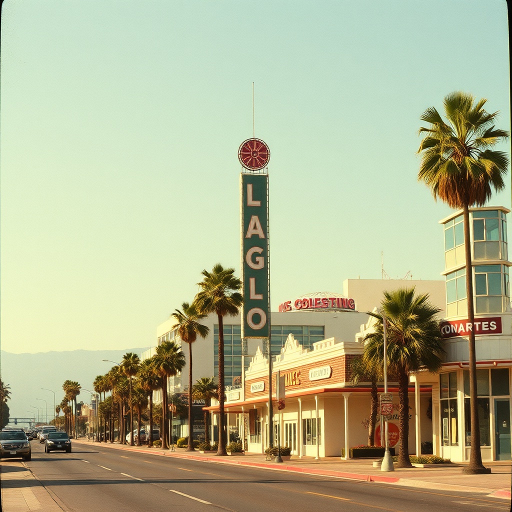
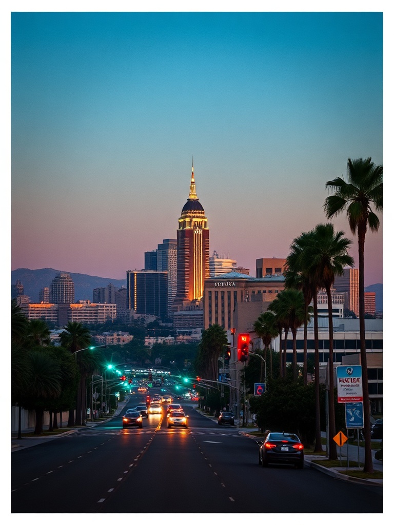
Los Angeles Day & Weekend Guide: Beaches, Neighborhoods, Eats & Transit Tips

Los Angeles is a city of contrasts: sun-baked beaches, foggy coastal mornings, palm-lined boulevards, and rugged canyons.

For visitors and locals alike, the key to getting the most out of LA is embracing its microclimates, neighborhood variety, and endless cultural options. Here’s a practical guide to planning a rewarding day or weekend in LA, with tips for getting around, what to see, and where to eat.

Start with the outdoors
Mornings along the coast can be cool and misty, making sunrise walks or bike rides perfect.

Venice Beach and Santa Monica offer iconic boardwalks, outdoor exercise areas, and easy bike rentals. For quieter sand and dramatic cliffs, head to Point Dume or El Matador State Beach. If you prefer hills and panoramic views, Griffith Park and Runyon Canyon deliver cityscapes framed by the Hollywood Sign and sweeping downtown vistas.

Neighborhood hopping
Each neighborhood has its own personality. Echo Park and Silver Lake blend indie shops, coffee roasters, and vintage stores with easy park access.

Downtown LA’s Arts District and Grand Central Market combine galleries, street art, and a booming food scene. West LA and Beverly Grove are great for boutique shopping and dining, while Koreatown and Little Tokyo offer late-night eats and authentic cultural experiences.

LA image

Food and drink
LA’s food scene is diverse and dynamic. Tacos and street food are must-tries—look for long lines at local taquerias as a reliable signal of quality. Food halls like Grand Central Market or upscale markets across the city make sampling simple.

For a more curated experience, scout neighborhood restaurants known for farm-first menus or chef-driven tasting options. Coffee culture is strong: independent roasters and specialty cafes are scattered throughout the city, great for people-watching and planning the next stop.

Getting around efficiently
Traffic is part of the LA experience, but thoughtful planning reduces stress. Use public transit in dense areas—metro lines and buses can be faster than driving during peak hours. For flexible routes, rideshares are convenient; parking apps help find and reserve spots in crowded neighborhoods. If exploring beaches and canyons in one day, plan routes to avoid backtracking across the city. Consider combining transit with short rideshare hops for the last mile.

Cultural highlights and nightlife
LA’s cultural calendar is always lively. Theatres in Hollywood, museums in Miracle Mile, and performance venues downtown offer varied programming. Art walks and open studios are common in many neighborhoods, providing a low-cost way to engage with the local scene. Nightlife ranges from rooftop bars and jazz clubs to intimate live-music venues—check neighborhood event listings for pop-up shows and food-driven late-night experiences.

Sustainability and smart travel
Eco-conscious options are increasingly accessible. Bike lanes and electric scooters make short hops practical, and many eateries prioritize local sourcing and waste reduction. Pack a reusable bottle, support local vendors, and choose transit options that cut down on car trips.

Practical tips
– Start early to beat traffic and catch cooler temperatures for hikes and beach strolls.
– Layer clothing to handle coastal fog and inland heat.

– Download transit and parking apps before you go.
– Make reservations for popular restaurants and weekend hikes when possible.

Los Angeles rewards curiosity and flexibility. Whether chasing a sunrise on the beach, discovering a new neighborhood coffee shop, or catching a late-night show, a little planning goes a long way toward an unforgettable LA experience.

Posted in LA

Here are five SEO-friendly title options—pick one or tell me if you want a shorter/longer or more playful variant:

Getting Around Los Angeles Without a Car: Practical Tips and Neighborhood Picks

Los Angeles is famously car-centric, but the city’s transportation landscape has evolved.

Whether you’re visiting or looking to spend more days without driving, a mix of public transit, micromobility, and smart planning can turn LA into a surprisingly walkable, bikeable, and transit-friendly place.

Public transit basics

LA image

LA’s transit network includes subway, light rail, and bus options that reach major neighborhoods and attractions. A reloadable fare card or transit app simplifies transfers and can save money.

Look for frequent lines that connect downtown hubs with coastal areas and cultural districts. Using official transit apps or third-party journey planners helps compare routes, times, and service alerts.

Micromobility and bike options
Protected bike lanes and new cycling infrastructure have made many parts of the city safer for riders. Bike-share programs, dockless e-bikes, and scooters provide flexible first- and last-mile solutions.

When using micromobility, follow local helmet and parking rules, lock your bike in secure areas, and use bike lanes where available. Many neighborhoods are compact enough that a short bike ride gets you to coffee shops, parks, and markets faster than driving.

Ride-hailing and car-share
Ride-hailing services and short-term car or EV rentals fill gaps in the transit network, especially for late-night trips or routes with limited service. Consider combining modes: take transit for the long portion of a journey, then use a ride-hail or scooter for the final leg. Look for designated pickup zones at major transit stations to avoid congestion and fines.

Neighborhoods worth exploring without a car
– Downtown Los Angeles: Rich in museums, theaters, and dining, the central core is increasingly walkable and served by multiple transit lines. Historic districts and new mixed-use developments make walking rewarding.
– Santa Monica and Venice: Coastal vibes and beachfront paths are accessible by rail and bus. Once there, riding or walking along the boardwalk is the most enjoyable way to experience the area.
– Hollywood and Koreatown: Dense commercial corridors with late-night dining and cultural spots. These neighborhoods are well connected and good for short walking tours.
– Echo Park and Silver Lake: Trendy, hillside neighborhoods with indie shops, coffee houses, and lakeside walks that are comfortable to explore on foot or by bike.
– The Getty and Museum Row: Major museums and cultural centers often offer shuttle connections or good transit links from central hubs.

Safety and comfort tips
– Plan routes in advance and check live transit updates to avoid long waits.
– Travel during daylight on unfamiliar routes and sit near other passengers or in marked car-share areas when possible.
– Carry a portable charger, refillable water bottle, and sunscreen—LA’s weather encourages outdoor time.
– Be mindful of peak commute hours and major event schedules that can affect service and traffic.

Sustainable, local, and practical
Choosing to go car-free or car-light reduces emissions and often leads to more neighborhood discovery. Shopping locally, visiting parks, and using transit for cultural outings supports both the environment and small businesses. Try a weekend itinerary that relies entirely on transit and micromobility to experience the city at a slower, more connected pace.

Whether you’re a resident trimming transportation costs or a visitor seeking a different side of LA, a little planning unlocks a lot of discoveries without needing a car.

Posted in LA

Los Angeles is redefining what a car-centric city can be.

Los Angeles is redefining what a car-centric city can be. Once synonymous with wide freeways and surface parking, the city is shifting toward people-first streets, greener public spaces, and more connected neighborhoods. That transformation is subtle in some blocks and bold in others, but it’s reshaping daily life for residents and visitors alike.

What’s changing on LA streets
A growing number of neighborhoods now feature pedestrian plazas, widened sidewalks, and protected bike lanes that prioritize safety and comfort.

Open Streets and car-free events temporarily reclaim major corridors for walking, biking, and neighborhood programming, which often become templates for permanent changes. Transit agencies continue expanding rail and rapid bus services, making it easier to rely on public transit for commutes and errands instead of driving.

Greening and climate resilience
Los Angeles is investing in urban cooling strategies to combat heat islands and protect public health. Tree planting campaigns, shade structures, cool pavements, and permeable surfaces reduce surface temperatures while improving stormwater management. Drought-conscious landscaping—using native and low-water plants—keeps sidewalks looking lively without heavy irrigation. These projects are frequently paired with neighborhood improvements, enhancing both aesthetics and environmental performance.

Economic and community benefits
Pedestrian-friendly streets boost local businesses. Cafes and shops near plazas or well-designed sidewalks often see increased foot traffic, and street closures for markets and festivals provide low-cost opportunities for entrepreneurs. Public space investments also strengthen community ties: residents collaborate on design, programming, and maintenance, ensuring spaces reflect local culture and needs.

Safer streets and active transportation
Protected bike lanes and traffic-calming measures reduce collisions and encourage biking and walking. Micromobility—shared bikes and e-scooters—complements transit and helps cover last-mile gaps.

Cities are pairing infrastructure upgrades with education campaigns and enforcement strategies to create clearer, safer rules for everyone on the road.

How to experience and support the shift
– Find plazas and open streets: Local city websites and neighborhood social channels list temporary closures, markets, and plazas. These events are great for sampling local food, music, and art.
– Try multimodal trips: Combine rail or bus with a bike or scooter to reach destinations that aren’t directly on transit lines. Many transit agencies and apps now integrate payment and trip planning across modes.

LA image

– Support local businesses: Frequenting shops and cafes near newly activated spaces helps sustain programs and shows the value of pedestrian-focused design.
– Get involved: Community workshops and meetings shape how public space is designed and programmed. Voice priorities—shade, seating, lighting, or family-friendly features—so projects reflect neighborhood needs.

Challenges and opportunities
Equitable distribution of improvements remains a central issue. Advocacy is pushing for investments in underserved neighborhoods, where better streets can deliver the most dramatic quality-of-life improvements. Maintenance, safety, and funding are ongoing concerns, but public-private partnerships and community-led stewardship models are emerging as effective solutions.

A more walkable, connected Los Angeles is not a distant dream—it’s unfolding block by block. Whether you’re exploring a neighborhood plaza, hopping on a protected bike lane, or taking a shorter car-free trip, these changes offer fresher, healthier, and more vibrant ways to move around the city. Keep an eye on local planning efforts and neighborhood initiatives to make the most of what’s opening up around you.

Posted in LA

Micro-Interactions That Make or Break User Experience

The difference between a good interface and a great one often comes down to details most users never consciously notice. A button that provides haptic feedback when pressed. A form field that validates input before submission. A loading indicator that shows actual progress instead of spinning endlessly.

These micro-interactions—small, focused moments of engagement—create the emotional texture of user experience. Done well, they make interfaces feel responsive, intelligent, and trustworthy. Done poorly or omitted entirely, they leave users uncertain and frustrated.

Feedback Loops Build Confidence

Every user action should trigger immediate feedback confirming the system received and processed the input. This principle seems obvious, but countless interfaces violate it constantly.

Click a button and nothing happens for three seconds? Users will click again, potentially triggering duplicate actions. Submit a form without confirmation? Users wonder if it worked or if they should try again.

“Users need constant reassurance that the system is responding,” explains Osman Gunes Cizmeci. “Micro-interactions provide that reassurance at every step, reducing anxiety and building trust in the interface.”

Visual feedback ranges from subtle color changes on hover states to satisfying animations when completing tasks. Haptic feedback on mobile devices adds tactile confirmation. Audio cues work for accessibility and provide additional reinforcement for key actions.

Progress Indicators Manage Expectations

Waiting feels longer when you don’t know how long you’ll wait. Generic spinning loaders tell users something is happening but provide no context about duration or progress.

Better approaches show actual progress when possible. File uploads display percentage completion. Multi-step processes indicate current position and remaining steps. Even when exact duration is unknown, animated indicators that show active processing feel more responsive than static loading states.

Context matters too. A three-second delay feels acceptable when uploading large files but unacceptable when loading a simple page. Micro-interactions should match user expectations for the task’s complexity.

Error Handling Shows Personality

How interfaces handle mistakes reveals their true character. Harsh error messages blame users. Generic alerts provide no guidance for correction. Good error handling treats mistakes as collaboration opportunities.

Inline validation catches errors before submission. Helpful messages explain what went wrong and suggest corrections. Visual cues highlight problematic fields without aggressive red alerts that feel punitive.

“Error states are where you show users you’re on their side,” notes Osman Gunes Cizmeci. “The micro-interactions around errors—how quickly you catch them, how clearly you explain them, how easily you let users fix them—determine whether mistakes feel frustrating or manageable.”

Transitions Create Spatial Understanding

Abrupt changes between states disorient users. Smooth transitions help people understand how interface elements relate spatially and hierarchically.

When a modal appears, subtle animation showing it sliding in from above or fading in helps users understand it’s layered over existing content. When navigation expands, animation reveals the relationship between collapsed and expanded states. These transitions don’t need to be elaborate—simple, fast movements provide sufficient context without slowing interaction.

The Cumulative Effect

Individual micro-interactions might seem trivial. Their cumulative effect defines interface quality. An app with hundreds of thoughtful micro-interactions feels polished and professional. The same app without them feels rough and incomplete, even if core functionality is identical.

The best micro-interactions are invisible in the sense that users don’t consciously notice them—they just feel the interface works smoothly. When interactions require conscious attention, they’ve failed their purpose.

Investing time in these details separates adequate interfaces from exceptional ones.

Los Angeles Without a Car: A Practical Guide to Transit, Bike-Share & Neighborhoods

Getting around Los Angeles without a car is easier than many expect. With expanding transit options, growing bike infrastructure, and reliable rideshare services, LA has become a city where exploring neighborhoods on foot, rail, or two wheels is practical and enjoyable. Here’s a practical guide to navigating LA like a local.

Plan around hubs
Los Angeles is built around several transit and activity hubs. Downtown (DTLA) connects multiple rail lines and buses and is a great jumping-off point for cultural districts, food halls, and walking tours. Santa Monica and Venice offer coastal paths and frequent buses; Hollywood and Koreatown are dense with restaurants and nightlife accessible by rail and short rideshares.

Identifying a hub near the places you want to visit cuts transfer time and keeps travel simple.

Use the right apps and passes
Download the transit provider app for schedules, service alerts, and fare purchase.

Look for mobile ticketing or reloadable cards accepted across buses and rail.

Real-time apps that combine transit, bike-share, scooter availability, and walking directions make it easy to compare options for any trip.

Combine transit with micro-mobility
Micro-mobility fills the “last mile” gap. Bike-share and e-scooters are common near stations and commercial corridors; they’re perfect for short hops, beach paths, and neighborhood cruising.

Many stations offer secure bike parking and some rail cars allow bikes during off-peak hours. If you’re planning several short trips, a day pass for bike-share can be cost-effective.

Time trips to avoid congestion
Traffic patterns can add a lot of time to surface transit and rideshare trips.

If you need reliable arrival times, use rail when possible—lines often bypass street congestion.

For bus travel, check express routes and limited-stop services that shave minutes off long corridors. When driving or ridesharing, schedule travel outside peak commute hours when possible.

Dress for microclimates
LA’s geography creates sharp weather contrasts. Coastal areas stay cool and breezy while inland neighborhoods can feel warm and dry. Layering is practical: mornings and evenings can be cool, afternoons warm. Comfortable, supportive shoes matter—many of LA’s most interesting streets are best explored on foot.

Safety and etiquette
Follow local rules for helmets and where scooters or bikes can be ridden. Lock bikes to designated racks or secure anchors.

On transit, keep belongings close and be mindful of rush-hour crowds. For quieter travel, pick less busy cars or wait for the next train—many stations have frequent service on major corridors.

Explore by neighborhood
– Downtown: arts, architecture, markets, and connected rail lines.

– Koreatown and Westlake: dense dining scenes and quick transit access.

– Silver Lake and Echo Park: walkable streets, indie shops, and local coffee culture.
– Venice and Santa Monica: beachfront paths, bike lanes, and lively boardwalks.

– Hollywood and West Hollywood: nightlife, theaters, and pedestrian-friendly corridors.

Sustainability and cost savings

LA image

Using transit and micro-mobility reduces your carbon footprint and often saves money compared with car rental and parking.

Many transit passes and bike-share memberships offer day and multi-day options that make sense for visitors and locals alike.

With a little planning and the right apps, Los Angeles becomes a mosaic of walkable neighborhoods, scenic bike rides, and efficient rail connections. Embrace the mix—ride a train into DTLA for a museum morning, switch to a bike-share for a lakeside cruise, and finish with dinner in a neighborhood you’d never have found by freeway alone.

Posted in LA

Is Los Angeles Becoming Walkable? Safer Streets, Better Transit

Los Angeles is shedding its reputation as a city built only for cars.

Across neighborhoods from downtown to the coast, a mix of transit improvements, protected bike lanes, pedestrian plazas, and street-safety initiatives is making LA more walkable, safer, and easier to enjoy without driving.

Why walkability matters for LA
Walkable streets boost local businesses, reduce traffic congestion, improve public health, and lower emissions. For residents and visitors, a more pedestrian-friendly LA means easier access to restaurants, parks, arts venues, and neighborhoods like Koreatown, Echo Park, Silver Lake, and Venice, where strolling and exploring are part of the experience. Walkable neighborhoods also increase property values and make daily life less stressful by cutting down commute time and reliance on parking.

What’s changing on LA streets
Efforts across the city are adding protected bike lanes, widening sidewalks, installing curb extensions and crosswalks, and creating pedestrian-priority plazas. Local agencies are coordinating on Vision Zero-style safety campaigns to reduce collisions and improve intersections. Transit agencies are improving connections between light rail, buses, and last-mile options like bike-share and e-scooters, so trips that once felt car-dependent can now be done by a mix of walking and transit.

LA image

Design features that improve safety and comfort
– Protected bike lanes: Physically separated lanes give cyclists safer routes away from vehicle traffic, encouraging more people to ride for short trips.
– Pedestrian bulb-outs and curb extensions: Shorten crossing distances and increase visibility between drivers and people on foot.
– Raised crosswalks and refuge islands: Slow vehicle speeds and provide safe mid-crossing rests on wider streets.
– Greening and shade: Street trees and planted medians reduce heat, improve air quality, and make walking more pleasant.
– Transit-first corridors: Streets prioritized for buses and light rail reduce delays and create reliable alternatives to driving.

Tips for walking and using transit in LA
– Plan multimodal trips: Combine transit for longer legs with walking or bike-share for last-mile connections. Apps that show real-time transit and bike availability make this simple.
– Pick walkable neighborhoods: Areas with mixed-use development—stores, cafes, and services within easy reach—are best for pedestrian outings.
– Time trips for comfort: LA’s climate is favorable for walking much of the year, but mornings and evenings can be cooler; mid-day shade and hydration matter on hotter days.

– Respect micromobility rules: Use bike lanes where provided, park shared bikes and scooters in designated racks, and follow local speed and sidewalk rules.
– Stay visible and cautious: Use crosswalks, make eye contact with drivers, and avoid distracted walking near busy streets.

Challenges that remain
The city’s scale and car-oriented history mean change takes time.

Major arterials can still feel hostile to pedestrians, and coverage gaps in transit and protected lanes leave some neighborhoods behind. Equity-focused planning remains important so improvements reach communities that need them most.

How to get involved
Community input often shapes which streets get upgrades. Attend local neighborhood council meetings, follow city mobility plans, or engage with transit agency outreach. Supporting local businesses and choosing active travel when possible also signals demand for continued investment in walkable streets.

Walkable Los Angeles is becoming a practical reality rather than an ideal. With coordinated design, smarter transit connections, and community involvement, streets are transforming into safer, greener places where walking and rolling are attractive options for everyday life.

Try exploring a new neighborhood by foot or transit and see how different parts of the city reveal themselves at a walking pace.

Posted in LA

Los Angeles is famous for sunshine, but abundant sun also means heat.

Los Angeles is famous for sunshine, but abundant sun also means heat. As temperatures trend warmer and built surfaces hold more heat, many neighborhoods experience stronger and longer heat events. That reality has sparked practical, neighborhood-scale responses that anyone can apply to stay comfortable, cut energy bills, and make streets more livable.

Why urban heat matters
Dense development, dark roofs and pavements, and sparse tree cover create heat islands — pockets that can be several degrees hotter than surrounding areas. Beyond comfort, excess heat raises electricity demand, strains health for vulnerable residents, and accelerates air pollution chemistry.

Addressing heat is about public health, energy resilience, and neighborhood quality of life.

What’s making a difference
Cities across the region are expanding tree planting, promoting cool and green roofs, and investing in shade structures and community cooling centers. These strategies reduce surface temperatures, lower indoor cooling needs, and improve walkability.

Private homeowners, renters, and local businesses can use the same toolkit to create cooler microclimates.

Practical steps for homes and blocks
– Grow shade and native plants: Trees are the single most effective long-term cooling investment. Choose drought-tolerant, native or climate-adapted species for lower maintenance and water needs.

If space is limited, espaliered trees, large container trees, or fast-growing shade vines on trellises can help.
– Cool roofs and reflective surfaces: Painting roofs a reflective color or installing a cool-roof membrane drops roof surface temperatures and reduces attic heat gain. Lighter paving or permeable pavers for driveways and patios keep outdoor areas cooler too.
– Green roofs and rooftop gardens: Where structural capacity allows, green roofs provide shade, insulation, stormwater benefits, and habitat — and they extend roof life. Even a modest rooftop container garden helps reduce heat absorption.
– Shade structures and fenestration: Awnings, pergolas, and trees positioned to block afternoon sun can dramatically reduce indoor cooling needs.

Interior solutions like blackout shades or reflective films for west- and south-facing windows cut heat gain without sacrificing daylight.

LA image

– Water-wise landscaping: Use mulch, drip irrigation, and soil amendments to reduce water use while keeping plants healthy. Group plants by water needs (hydrozoning) and choose native grasses, succulents, and shrubs that thrive in local conditions.
– Smart cooling choices: Ceiling fans, smart thermostats, and zoning help minimize energy use.

When replacing an AC, choose high-efficiency models sized correctly for the space.

Community actions that scale
Neighborhood associations and local businesses can collaborate on tree planting days, community shade projects for bus stops and playgrounds, and cool pavement pilot projects. Schools and faith institutions often make effective cooling hubs during heat events. Residents can advocate for expanded urban canopy programs and support policies that require or incentivize cool roofs, permeable surfaces, and green infrastructure in new development.

Health and preparedness
Heat affects everyone but hits elderly people, young children, outdoor workers, and people with certain medical conditions hardest.

Know local cooling center locations, check on neighbors during hot spells, and develop a household cooling plan. Hydration, shade, and limiting strenuous activities during peak heat hours help reduce risk.

LA’s climate will keep shaping how people live in the region’s neighborhoods.

By combining individual home improvements, community projects, and support for policy measures that prioritize shade and reflective surfaces, residents can cool streets, lower bills, and build healthier, more comfortable places to live. Check municipal resources for incentives and planting guidance to make the most of local programs.

Posted in LA

How Los Angeles Is Reinventing Mobility: Transit Expansion, Micromobility & Safer Streets

Los Angeles is retooling how people move — and the shift is more than new trains and bike lanes. A blend of transit expansion, micromobility growth, safety initiatives, and tech-driven planning is turning LA into a model for large-city mobility reinvention. For residents and visitors, that means more choices, more reliable options, and a clearer path toward cleaner air and shorter commutes.

Why LA is rethinking mobility
Traditionally defined by car culture, LA faces congestion, air quality concerns, and uneven access to opportunity. That has pushed city and regional agencies to prioritize alternatives that reduce driving while improving access for neighborhoods that have been underserved.

The result is a coordinated push across rail, bus, bikes, scooters, and pedestrian infrastructure.

Big-picture changes you’ll notice
– Transit upgrades: Heavy rail and light rail projects are expanding the reach of the metro network, plugging gaps between neighborhoods and key job centers. New stations and improved service frequency are designed to make transit a realistic daily choice for more Angelenos.
– Bus improvements: Dedicated bus lanes, technology that prioritizes buses at intersections, and redesigned routes focus on reliability and speed. Riders see fewer delays and shorter trip times when buses avoid traffic chokepoints.
– Micromobility everywhere: Bike-share and electric scooter programs have matured with better safety rules, more parking options, and apps that integrate multiple providers. Protected bike lanes and bike boulevards make cycling more appealing beyond the core downtown area.
– Seamless trip planning: Unified fare systems and multimodal trip planners let riders combine rail, bus, bike share, and scooters in one trip with little friction. Payment apps and contactless fares reduce the hassle of transfers.

Safety and equity at the core
Vision Zero-style initiatives aim to reduce traffic fatalities by redesigning streets, lowering vehicle speeds in dense areas, and improving crosswalks. Equity-focused programs prioritize transit access in communities historically underserved by infrastructure investments, ensuring benefits aren’t limited to already well-connected neighborhoods.

Environmental and economic payoffs
Reducing single-occupancy car trips improves air quality and lowers greenhouse gas emissions.

Efficient transit and denser, walkable neighborhoods also support local businesses by encouraging foot traffic.

LA image

For commuters, time saved and lower transportation costs translate to better quality of life.

How to take advantage of changes
– Use multimodal trip planners to compare time and cost across options. Combining a short bike ride with a rail trip often beats driving in both time and expense.
– Pick a transit-friendly neighborhood for shorter everyday trips and more reliable access to jobs and services.
– Embrace micromobility for last-mile connections. Learning safe parking and riding etiquette helps keep sidewalks and streets safer for everyone.
– Join local advisory meetings or community planning sessions. Public input frequently shapes where lanes, stations, and safety upgrades are built.

What to watch next
Expect continued refinement of routes, more protected bike infrastructure, and smarter traffic management using real-time data.

Funding and politics will influence the pace, but the overall trajectory favors a more connected, sustainable LA.

For anyone navigating the region, the takeaway is clear: mobility options are broadening and becoming more practical. Whether commuting, running errands, or exploring neighborhoods, planning ahead and mixing modes can unlock faster, greener, and more enjoyable trips around Los Angeles.

Posted in LA

Best Outdoor Activities in Los Angeles: Beaches, Hikes, Parks & Outdoor Dining

Los Angeles is best experienced outdoors. With varied microclimates, coastal breezes, urban parks and mountain views, the city invites exploration beyond pedestrian malls and freeways. Whether you’re a visitor or rediscovering local favorites, these outdoor experiences showcase why LA’s public spaces are among its greatest assets.

Top outdoor picks
– Griffith Park and Observatory: Trails range from gentle paths to steep switchbacks with panoramic views of the city and the famous hillside landmark.

LA image

The observatory’s terraces offer skyline photo opportunities without stepping inside.
– Beaches and bike paths: The Santa Monica–Venice coastal stretch is ideal for a seaside ride or walk along the Marvin Braude Bike Trail. For quieter shoreline time, head toward more secluded coves and bluffs north of the city for tide pools and dramatic views.
– The Getty Center gardens: Sculpted gardens, terraced landscapes and outdoor sculpture collections pair art with some of the best landscaped city views available.

Arrive early for softer light and fewer crowds.
– LA River and new greenways: Stretching through neighborhoods, revitalized river sections now feature walking and biking paths, pocket parks, and public art—an evolving urban ribbon connecting communities.
– Echo Park Lake and paddle boating: Rent a pedal boat for a relaxed hour on the water with downtown skyscrapers as a backdrop, or stroll the lakeside for gardens and local vendors.
– Urban hikes and canyons: Runyon Canyon, Baldwin Hills Scenic Overlook and the trails threading the Santa Monica Mountains offer quick escapes where skyline panoramas meet native coastal vegetation.

Outdoor dining, markets and nightlife
Outdoor dining remains a highlight across Los Angeles neighborhoods. Rooftop bars, shaded patios, and food halls with open-air seating keep the city’s culinary scene fresh and accessible. Farmers markets are a weekend staple—perfect for sampling seasonal produce, artisanal foods and neighborhood character.

For nightlife, outdoor concert series, pop-up events and evening markets make it easy to enjoy music and food while staying alfresco.

Getting there and getting around
Traffic can be unpredictable, so mix transportation modes. The Metro system, supplemented by light rail and frequent buses, connects major neighborhoods and is increasingly useful for avoiding parking hassles. Bike lanes and shared-mobility options cover many corridors; docking systems and scooters are widespread but check local rules and parking areas. For longer trips across the region, rideshare offers flexibility, while car-free itineraries work well for concentrated neighborhoods like Downtown, Westside beach cities, and parts of Hollywood.

Practical tips for outdoor days
– Layer up: Coastal fog and inland heat can vary by a few degrees, especially from morning to evening.
– Sun protection: Hats, sunscreen and a refillable water bottle are essentials for hikes and beach days.
– Plan ahead: Popular viewpoints and attractions get busy—reserve timed entries when available or aim for early mornings and late afternoons.

– Respect local ecosystems: Stay on marked trails, pack out trash, and follow posted guidelines for beaches and wildlife areas.

Whether you’re chasing ocean air, mountain views, or vibrant neighborhood life, LA’s outdoor offerings make it easy to craft a day that feels both expansive and immediate. With so many ways to get outside, each visit can reveal a new corner of the city.

Posted in LA

Los Angeles is redefining the daily commute.

Los Angeles is redefining the daily commute.

A mix of expanding public transit, growing bike and scooter networks, and app-driven last-mile services is making it easier to leave the car at home — at least for parts of the trip. For Angelenos and visitors alike, understanding how micromobility and integrated transit are working together can turn a stressful drive into a quicker, cleaner journey.

Why micromobility matters in LA
Micromobility — electric bikes, scooters, and shared pedal bikes — fills the gap between transit stops and final destinations. In dense neighborhoods and commercial corridors, these small vehicles shave minutes off trips that once required long walks or expensive rideshares. They reduce car trips, lower emissions, and expand access where transit coverage is limited.

Where micromobility is moving the needle
– First/last-mile integration: Transit agencies and private operators are coordinating better. Many rail and bus stations now feature bike racks, scooter parking zones, and wayfinding that links platforms to nearby micromobility options.
– Protected infrastructure: New protected bike lanes and curb treatments create safer routes, encouraging more people to ride. Streets that once felt hostile to cyclists are being reimagined with buffered lanes and priority signals.
– Shared fleets and equity programs: More operators offer low-cost or subsidized plans, with partnerships focused on neighborhoods historically underserved by transit. Community docking stations and subsidized passes help bridge mobility gaps.

Benefits for commuters and neighborhoods
– Quicker multimodal trips: Combining a transit leg with an e-scooter or e-bike often beats driving during peak congestion, especially across short to medium distances.
– Cost savings: For many riders, a combined transit plus micromobility trip costs less than parking and gas for the same distance.
– Health and livability: Increased walking and cycling bring cardiovascular benefits and help create calmer, more pedestrian-friendly streets.

Challenges to address
– Safety and education: As ridership grows, so do concerns about collisions and sidewalk clutter. Investing in rider education, helmet access, and enforcement of parking rules helps mitigate these issues.
– Charging and maintenance: Shared electric fleets require reliable charging and upkeep. Expanding micro-hubs for charging and servicing vehicles keeps fleets available when demand spikes.
– Equity and accessibility: Ensuring devices are available in all neighborhoods and accessible to riders with disabilities requires continued policy attention and creative operator partnerships.

What to expect when planning a trip
– Use transit apps that show multimodal options.

Many apps now combine rail, bus, scooter, and bike availability so riders can compare time and cost in one view.
– Look for designated parking zones. Properly parked scooters and bikes reduce curb clutter and help maintain good relationships between operators and communities.
– Try e-bikes for hills. Electric-assist bikes expand the practical range of two-wheeled trips across LA’s varied terrain.

How local policy can help
Supportive street design, consistent parking rules, and data-sharing requirements for operators create a predictable environment for riders and cities alike. Prioritizing safety investments and subsidized access programs ensures benefits reach a broad cross-section of residents.

LA image

Los Angeles’ transportation landscape is changing from gridlocked car-centric corridors to layered, flexible networks. When public transit, protected infrastructure, and micromobility converge, the commute becomes faster, cleaner, and more equitable — transforming how people move across the region one short trip at a time.

Posted in LA